Quantcast
Channel: Places near Pune and Mumbai
Viewing all 81 articles
Browse latest View live

Aba Bagul Garden near swargate

$
0
0

Aba Bagul Garden Swargate Pune

Pune may seem a very crowded city with chaotic traffic, but in the middle of all this chaos Pune has many small yet beautiful gardens. These gardens provide the much needed evening break. Aba Bagul garden is one such park. You wouldn’t even notice this garden, but once you get inside it has got things for people of all ages.

Aba Bagul Garden Swargate Pune

When we visited the Seven wonders park, we heard about this park but no one could direct us to it. Then, many months later i saw an article on this park. So, this came back on the radar. On our way back from Jarseshwar temple, we visited this park. The park closes during noon and opens at 4.30 pm. the part which i didn’t like was that cameras are not allowed! I tried to reason it out with the guards, but they were just doing what they were told to do! Mobile cameras though are allowed. I have a long way to go in terms of mobile photography, so the photos on this post may not up to the mark :-)

Aba Bagul Garden Swargate Pune

The park has many attractions. The most noticeable ones are the huge animal statues located all over the park. The kids loved these.

Aba Bagul Garden Swargate Pune
aba_bagul_garden_pune3.jpg

Aba Bagul Garden Swargate Pune

The park also has a “museum” dedicated to Pandit Bhimsen Joshi. A part of this museum houses many photographs under the banner of “100 years of Bollywood Cinema”. This would be fascinating for any Bollywood lover. Unfortunately, no cameras were allowed inside.

Aba Bagul Swargate Pune

There is more to the park. There is a mirror maze on the first floor of the museum. This was not a patched up low budget one. The maze was very good and lot of fun. Akshara wanted to try the maze again and again. Easily the best part of the park. No cameras here too. a must visit! The park also has a musical fountain show, but the shows start at around 6.45 pm. We didn’t hang around that long. You can combine a visit to this park with the seven wonders park. That way, you can cover both parks in the evening and then catch the musical fountain too. I have given the route to the park (from Magarpatta) below. The two destinations marked are this park and the seven wonders park.


Kelshi beach on the konkan coast

$
0
0

Kelshi beach village

Kelshi is a small village to the south of Velas. It is not very high on the tourist circuit and hence less crowded. I had visited Velas during the ‘Holi weekend’ and had visited Kelshi a day before. It turned out to be a nice choice as the village was extremely calm and the beach was very very clean! It seems that this village does pull in crowds during the monsoon, but the kind of crowds who want to relax.

Most of the narrows streets in the village had a canal running through them. One of my friends told me that many villages in Goa have the same thing, but i was seeing this for the first time. This would make the place almost kerela-ish during the monsoon, with a small canal running through every street 🙂

kelshi village beach

We spent the early part of the evening at the beach. There was practically no one else on the beach but us. The sand was clean and so was the water. The kids had a good time on the beach. Since it was the Holi long weekend, we had got pichkaris for the kids. With the water problem hitting the residential societies hard, the unlimited water supply at the beach made the fun extra special!

Kelshi village Beach
Kelshi Village
Route to Kelshi Village (from Magarpatta city, Pune): Follow the directions in the map below. It is straight forward. Most of the route is on good roads. But the ones closer to Kelshi are ok-ok.

Places to see in Kelshi Village:
Strangely enough, the most popular attraction in the village are its sand dunes! No one knows how these dunes were formed, but like everything else in india, they are there because some god wanted them to be there. It seems that the people of this village have not approved the bridge across the river (which will shorten the route to velas by a ton) because it meant that this dune had to be removed. So, off we went in search of the dune. Take the road from within the village and not the one next to the beach. The one next to beach finishes in a marsh which is difficult cross either by foot or by a vehicle. Well, don’t expect sand dunes like those of a desert. There were few huge piles of sand which were the sand dunes. But the remarkable thing was the type of sand. They were indeed like a typical sand dune and none like the ones you will find next to a river/sea. This was the unexplainable bit. The sand was super soft. The kids enjoyed sliding down the dunes. The view of the backwater close to the dunes are amazing. There were few rundown ships. Not sure whether they were dumped or just parked for the low tide.

kelshi_village_beach2
Kelshi village sand dunes
Kelshi beach

There is a small Mahalaxmi temple in the village. It is a little away from the village and hence quite calm.

kelshi_village_beach8
Kelshi Village Mahalaxmi temple

A short uphill drive from the temple will lead you to Yakub Baba Darga. As the villagers told me, the existence of the temple and the darga close to each other signifies the peaceful coexistence of the communities in the village and that the Darga was a place of worship of people from all religions. Thsi darga has connections to the Shivaji era with his family having personally taken up the work of construction of it.The darga is located on a hill overlooking the coast and the view from it is awesome.

Kelshi Village Yakub Baba Darga

Jarsheshwar Temple near Khadakwasla

$
0
0

Jarsheshwar Temple near Khadakwasla

A suggestion by a reader of my blog took me to this place. A small temple in a remote location with a wonderful lavasa-type access road made it a great half-day trip. To my surprise, a search on google didn’t bring up any travelogues. All the mentions were related to plots available in that area. I love visiting such off-beat places.

Jarsheshwar_Temple_Khadakwasla

Location of Jarsheshwar Temple: The hill on which this temple is, is on the other side of khadakwasla dam, close to Splendour country club. Around 200 ms before Splendour Country club, you will see a private road branching off to the right, climbing the hill. This road has a check post. All you have to do is to make an entry and say that you are visiting the temple and you will be let through. The map below gives the route from Magarpatta city to Jarsheshwar Temple.


Jarsheshwar Temple
Jarsheshwar_Temple_Khadakwasla5
Jarsheshwar Temple

The climb from splendour country club to jarsheshwar is around 8-9 kms and is almost lavasa-like. Since it is a private road with many bungalows lined on the side, the road is a very well maintained smooth road and makes for great driving. The views at every turn will make you stop and hence plan for a long drive of 8-9 kms!

Jarsheshwar_Temple_Khadakwasla2

Jarsheshwar_Temple_Khadakwasla6

Jarsheshwar_Temple_Khadakwasla3

jarsheshwar temple khadakwasla

The temple was under renovation when i visited (if you have a pic of the renovated temple, pl do post in the comments). It is a simple one-roomed temple with a shrine and a Nandi. Outside the temple, there was a huge statue of a bull which excited the kids a lot. If you are in the area of khadakwasla, this is a good diversion to take.

Parsi point and Sydney point in Panchgani

$
0
0

parsi_point_sydney_point_panchgani

There are tons of viewpoints in Panchgani and Mahabaleshwar, but trying to fit in all of them on a day trip is just not possible. Some of the remote ones like Arthur’s seat (which probably is also the best one) require separate planning. But if you are on a quick visit, you can visit Parsi point and Sydney point which are on the main road itself (Sydney point is a very short drive off).

parsi_point_sydney_point_panchgani2

parsi_point_sydney_point_panchgani3

parsi_point_sydney_point_panchgani

Location: Sydney point is before Panchgani (going from Pune) and is great for sunsets. It is a short climb from the main road. Parsi point is between Panchgani and Mahabaleshwar.

parsi_point_sydney_point_panchgani5

Sydney Point Panchgani

Lenyadri Caves Ashtavinayak Temple

$
0
0

Lenyadri Caves Ashtavinayak Temple

The Lenyadri cave complex is a series of Buddhist rock-cut caves (like Karla, Bhaja), but also happens to have the only Ashtavinayak temple on a mountain! So, an easy climb to a beautiful cave complex with a great view and an ashtavinayak, what more do you need for a day trip?

Lenyadri Caves Ashtavinayak Temple

Lenyadri Caves Ashtavinayak Temple

Lenyadri is located a few kilometres away for Junnar and can be combined with many other popular destinations like Malshej Ghat, Shivneri Fort and Ozar Ashtavinayak temple. The climb will take around 20-25 mins and there are proper steps throughout the way. Even with Advika on the sling, it wasn’t much of a bother to climb. The kids also enjoyed the climb.

lenyadri_caves_ashtavinayak_temple1

Lenyadri Caves Ashtavinayak Temple

Route to Lenyadri Caves from Pune (Magarpatta City):

All the main caves are right at the point where you reach the plateau. They can be reached by climbing few rick-cut steps. It was fun climbing up and down to each of the caves. The steps provide lot of interesting photo opportunities too 🙂

lenyadri_caves_ashtavinayak_temple9

lenyadri_caves_ashtavinayak_temple7

lenyadri_caves_ashtavinayak_temple5

Lenyadri Caves Ashtavinayak temple

lenyadri_caves_ashtavinayak_temple6

Cave 6 is a chaitya griha and has a huge stupa, found in almost all buddhist caves. This one has a path to go around. Cave 7 has the ashtavinayak temple. This is a huge hall with a low roof. A visit to Lenyadri is an enjoyable and a relaxed one-day trip from Pune. The restaurant at the bottom of the hill gives an unlimited thali (great rotis!) for just 100 bucks a plate.

lenyadri_caves_ashtavinayak_temple11

Mulshi Tamhini Lonavala round trip

$
0
0

This was on the plan for a very very long time. Tamhini is a favourite haunt for us considering the relative ease with which a trip to tamhini can happen. Every time we were there, i used to stop at this bridge because it is a very photogenic place and with the stream in good flow, it is really beautiful. There is a worn-out sign board in front of the bridge which says “Lonavala” to the right. This has always intrigued me as Lonavala is somewhere out there and there is a route which is a white line on the maps with no villages around. So, finally in 2016, it happened. A short review: go ahead and get on this route, it is wonderful!

tamhini-lonavala-bridge

The map below gives the entire route that i took. if it is not clear, you can view the map directly here. I have split it into various sections with details below the map. Most of the route is bad road with lot of broken sections and potholes. The section behind Mulshi is pretty remote and the road was broken almost throughout. But it can easily be done. We went in a Xylo and a Nano and both came out fine. If the roads were slushy/muddy, then it is an issue, but here the roads were rocky and hence not much of a concern.

The route starts from Magarpatta city. For those familiar with the city, start directly at point B, which is Paud, Mulshi road. It being a sunday, we included Hadshi on the itinerary because 1) it is a beautiful temple and 2) They make onion bhaji on sundays in their canteen (apart from the usual sabudana, poha and bhel)

Hadshi temple on the way to pavana dam

After Hadshi, the route actually turns left at Javan, but you can continue on for few kms ahead to get great views of Tung Fort on the pavana backwaters. During good rains, you can even see an overflowing Pavana dam.

Pavana Dam near Lohagad

Once back to Javan, proceed towards Ghusalkhamb (the reference village in case you get lost). This is a beautiful stretch with many mini ghat sections giving you great views of Tung from the side. Another interesting place here is the Ajivali village, where you have a small walk to the Devrai Temple (Sacred grove).

mulshi-tamhini-lonavala-drive7.jpg

mulshi tamhini lonavala route

The stretch between E and F was really cool. It was a series of sharp hairpin bends right next to each other with a rapid descent. Was very cool to drive. Not sure how easy it is climb! Point G is the place where you meet the Lonavala-Amby valley main road. You can turn right for lonavala (no reason why to go to over-hyped, crowded Lonavala though). This is a slightly tricky junction. Turning left would take you through Amby valley to just before Mulshi. Going right and then left is the road to Korigad. The stretch from point G to Korigad fort is a beautiful lavasa-type road with trees on both sides of the road. A km after Korigad fort, there is a big junction where you have to take right (Point H). The next 30 odd kms are the highlight of this trip. A beautiful forest road, no civilisation, tons of waterfalls – awesome to drive on. The road condition is bad, but as i wrote before, it is all rocks and no mud, so slow and steady will take you through. A Xylo and a Nano made it through safe and sound. It was raining continuously and hence we lost out on many photo opportunities, but on a regular monsoon day, you will be stopping every few mins for a photo

mulshi-tamhini-lonavala-drive4.jpg

mulshi-tamhini-lonavala-drive6.jpg

mulshi tamhini lonavala road trip

You will come across dozens of streams criss-crossing the road. Some of them were almost like rapids. Due to the rains, we couldn’t get down at many places. But we did manage to explore some of them.

mulshi-tamhini-lonavala-drive3.jpg

waterfall streams in tamhini

Just before you reach the Tamhini main road, you will come to a view point called “Independence point”. it was mind blowing. A huge valley with mist flowing through it. but we reached there late in the day and couldn’t spend time there. Noted for the next trip 🙂 Once we reached Tamhini, we went to our usual food stop – Quick bite. But, i thunk i have to start looking at a new food stop because Quick bite has become super expensive nowadays e.g. Paneer Butter Masala costs 220 bucks!

If you reading this on a week where it has rained a lot, go for this road trip the coming weekend, satisfaction guaranteed!

Bhor Raireshwar Fort Wai Monsoon Drive

$
0
0

Bhor to raireshwar fort to wai route

As they say in movies, a wrong turn could take you to place you didn’t plan for. But in reality, missing a turn also has the same effect 🙂 But once we found the turn, it turned out to be a beautiful drive through an amazing ghat section. Raireshwar fort is actually a plateau with a village and is relatively easy to climb up to (we didn’t do the climb though). This place is popular post monsoon and rivals Kaas in the number and variety of wild flowers. Once while moving around on the map section, i found a very interesting curly road (always searching for curly roads!) and came across this…

raireshwar fort

The territory was familiar though. I am a regular on Bhor-Varandha route and the menavli ghat near wai. These are two parallel mountain ranges and i had also been to Mandardevi which is on the connecting road between Bhor and Wai. Now, this was another connecting route. Also i had seen a similar route for the HVK monsoon drive which happened in 2015. So, the plan was on. We go to Bhir, climb up to raireshwar climb down to Dhom dam backwaters, come to wai and eventually finish off with a sandwich at Mapro, which is our default food stop if we are anywhere in the area 🙂

This is the route we took (or rather we planned to take):

You can stop at the following places on the way: The U-Turn river near Bhor (check the bhor post for the location), an old hanging bridge in Ambawade (really cool). Once i plan the route, i don’t usually look at maps as i prefer to get around my asking people in case of a doubt. We had crossed Ambawade and all set to enter the ghat section of Raireshwar. But what i missed to notice was that a regular curve in the road was actually a very small left turn near a house (visible as a puddle of water due to the rain – doesn’t look like a turn aat all). There was a path ahead too and we continued. After a while, it became a proper mountain road. But the scenery turned awesome. If you view the map below in satellite mode and zoom in, you will see a ‘road’ going straight from from the first point. We just drove ahead 🙂 This is what we got to see on that section. In the first photo below, the track to the left was the ‘road’ we were driving on. At many curves, a green carpet welcomed us. At some points, i asked Vidhya to go ahead and confirm that there was something ahead that we could drive on 🙂


raireshwar fort route
bhor-raireshwar-fort-wai-trip2.jpg
bhor raireshwar wai route

We were in two cars – a Xylo and a Honday City. The Xylo kept trudging ahead not caring about the slush or the rocks. But we reached a stage when it was risky to keep the city moving ahead. At this point, someone in heavens told us that we were probably in the wrong place and we should be turning back. So, we did and went back a few hundred metres to the houses. Then while enquiring, they told us that the actual road was to the left and were wondering what we were doing with a car on a mountain road meant for goats!

bhor raireshwar wai route

Eventually, we did take the left. But that too had some rocky sections over streams. At one point, i was just relieved to see a proper tar road!

bhor-raireshwar-fort-wai-trip1.jpg

bhor raireshwar fort

After that, we climbed up then kenjaalgad ridge, came close to the exit of raireshwar and climbed down to Ghera Kanjal on to wai. This short climb up and down is BEAUTIFUL! Any car can manage it. then we finished off as planned in Mapro. Overall, a very interesting and adventurous road trip!

bhor raireshwar wai

Drive to Purandar Fort in the rains

$
0
0

Purandar fort is one of the closest forts to Pune. It is currently an army training facility and entry to it is a bit limited (in terms of time/route). The purandar hill can be divided into two sections. The middle section is where the army base is and the top section is where the remnants of the fort are. You can trek up or drive to the middle section (an interesting, easy trek of 45 mins). From the middle, it is another 25 min trek to the top through a series of zig-zags or a shortcut through a waterfall.

Purandar Fort Drive

View from Purandar Hill


Purandar fort drive

Entrance to Purandar fort

We reached Purandar late in the day around 4.45 pm after a day long road trip around Panwadi Ghat. We actually drove up to Purandar for chai and bhel 🙂 The road reaches up to an entry gate where you have show id-proof and then take your vehicle inside. It was raining a bit and full of mist, the place was ethereal.

DCIM103GOPRO

DCIM103GOPRO

DCIM103GOPRO

DCIM103GOPRO

Purandar Fort

Purandar Fort

We walked around near the church, had bhel and chai and by that time, the armymen came around asking all to leave the place – closing time is around 5.30 pm. The kids enjoyed the chillness and the mist!

DCIM103GOPRO

DCIM103GOPRO

DCIM103GOPRO

DCIM103GOPRO

DCIM103GOPRO

DCIM103GOPRO

Purandar Fort Drive

Purandar Fort

On the way to Purandar, you can also stop over at Sangameshwar Temple. To know more details like the route, please visit the other post on Purandar.


Vajrai Waterfalls near Kaas, Satara

$
0
0

I saw a news update on a Marathi channel about this waterfall around 2 years ago and it claimed that this waterfall could be India’s tallest waterfall. This was not a well-known waterfall and it is a bit tricky to reach to it. The main waterfall comprises of three layers and the new item said that if the three layers were taken together, it could rival Jog falls in height. The surprising part was this waterfall is very close to Kaas plateau which is extremely popular with visitors during the flowering season.

vajrai_waterfalls_near_kaas_satara

With a short trek, you can see the side view of the falls. But this means that we won’t be able to see the full three layers until the base. There is also a route to the bottom, but that requires a walk of around 3 hrs through rough terrain (guide required). Even for the side-view, i would recommend taking a guide (not expensive) unless you want an exploratory walk of your own.

Location of Vajrai waterfalls: Kaas lake is a little ahead of the main flowering area of Kaas. The parking on the other side of Kaas is next to the Kaas Lake. There is a small dam on the lake. This overflows and feed Vajrai Waterfalls. The dam is itself quite a popular picnic spot and you can find the usual crowds with Butta in their hands. You have to start your diversion from this point. The map below shows the section you can drive on and then a small walk will take you to the view of the falls. The first photo shows the location on the main road where you have to take the diversion to the left. There is a shop on the right, behind which is the path to the Kaas Lake. There is an old building on the left. This is the road you have to drive on.

Vajrai Waterfalls near Kaas, Satara
Kaas Lake Vajrai Waterfalls

This side-road is a kuchcha road, but can be managed in any car. Check out the vide i took on my return, to see the quality of the “off-road”. We took a guide from the shop – Jayaram. He was very good and patient. He had to be patient as we were with Advika (who was 7 months then) who had to be protected from the heavy wind and rain. This meant that our walk was slow. Also, every 10 ms required a photo session 🙂

vajrai_waterfalls_kaas_satara

We parked the car at a “junction” where there was a huge hill to the left. Then, we walked towards the valley to find an appropriate view point. The short walk (20 mins) was very interesting as heacy rain was on and off, but the wind was extreme. Look at what happened to a new umbrella!

vajrai_waterfalls_kaas_satara7

vajrai_waterfalls_kaas_satara2

vajrai_waterfalls_kaas_satara5

vajrai_waterfalls_kaas_satara9

Vajrai Waterfalls near Kaas, Satara

Then, we came to the edge of a rock beyond which we couldn’t go any further. The view of the falls (and its sound) was amazing. Well worth the effort. Hopefully, i will do the trek to its base soon. You can also get a view of the falls from the other side. Look at the map below. From the marked village, you can see the falls. Also, you can get a guide from that village (or Jayaram himself) and walk the forest to the base of the falls. I have seen some pics of the full falls taken from the base and it is amazing. The last video is of the kaas lake/dam.

vajrai_waterfalls_near_kaas_satara

Thokarwadi Dam – the best waterfall road trip near Pune

$
0
0

It is not often that i get floored by scenic beauty that i attach words like “best” to it, but this was one such trip. In the many years of travelling around Pune, particularly in the monsoon season in search of waterfalls, this route was the best i have ever been on! And, it is so close to Pune and the roads are very normal ones to drive on!

waterfall near pune road trip thokarwadi

The route: On the old Mumbai Pune, the toll plaza is at Somatane, close to Shirgaon and the Birla Ganapati. Around 15 kms ahead is the Kanhe Phata. You have to turn right on this and go on the road to Khandi. This is a 30 km one way trip. We had planned the round trip with the return coming on the other side of Thokarwadi, but as it got late we came back the same way. Villagers said that the other side doesn’t have good roads, but i guess it should be manageable. The below map shows the way from Magarpatta city. Essentially, it is a Kanhe Khandi road trip.

A few kms after Kanhe (after crossing the railway gate), the scenery starts. We have to cross a river. When we went, the river was almost to the level of the bridge and it was quite scary. There are numerous waterfalls to the side. The road is such that we have the mountains on the left and the backwaters of the dam on the right. The road is quite good with the occasional potholes. The first prominent waterfall was quite cool. It was on a private area and the old lady at the gate charged 50 rs per person. Totally worth the money! No idea who designed it, but they modified the natural waterfall to make it ten times more fun. Imagine you have a great waterfall, an infinity pool, a bushi dam feel all combined into one. There is a pool dug out at the base of the fall for people to swim in (and it is not too deep i guess as i saw even kids going in). Then the water flows over a series of steps making the whole place extremely photogenic.

waterfall near pune road trip thokarwadi

The next 10-15 kms had the highest density of falls i have ever seen and all of them big ones! It had rained heavily for the past few days and the water levels in all of them was amazing. You just have to stop every few min for a photo!

waterfalls_pune_mumbai_thokarwadi_dam2
waterfalls_pune_mumbai_thokarwadi_dam5
waterfall near pune road trip thokarwadi

A short drive later, you will see a board on the road pointing towards the left with a waterfall photo and mentioning food option! Don’t miss this! I have given the approx location of this place in the map below. There was no network there, so couldn’t mark the place. This will lead to a house. a 5 min walk from this house will take you to one of the most beautiful, crowd free, pollution free waterfalls! You can order food at this house and they will have great maharashtrian thalis ready for you when you come back (150 rupees for unlimited pitla, bhakri, rice and dal).

waterfalls_pune_mumbai_thokarwadi_dam10
waterfall near pune road trip thokarwadi

Here are some videos from the trip.


Velas Village Turtle Festival

$
0
0

Velas Village turtle festival

Velas is a remote village on the Konkan coast which comes into prominence on the tourist circuit from early feb to mid March. Olive Ridley turtles come to the Velas beach every oct-nov to lay their eggs. These turtles always return to the same beach they were born on. So, the ones coming now were the ones who were born on the same beach 12-15 years ago. Until about a decade ago, the turtle eggs were plundered by the villagers. With the joint efforts of a NGO (Sahyadri Nisarga mitra) and the village committee, the entire village has to taken to turtle conservation. During the egg laying season, the eggs are collected and kept in a protected area. During the hatching season i.e. Feb-mar, tourists flock to see the tiny turtles make their baby steps towards the might sea. This is truly a sight to watch.

Velas Village Turtle Festival

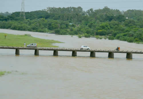
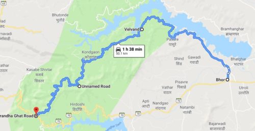
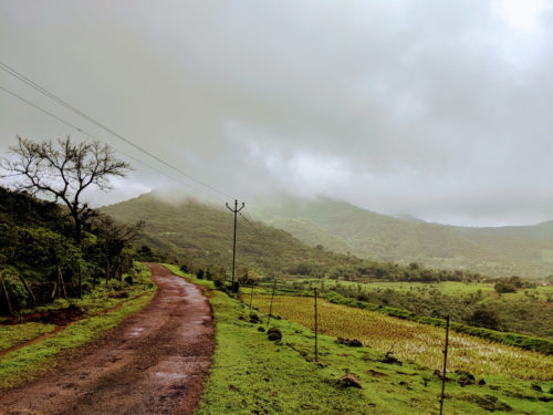
How to go to Velas: It is around 5-6 hours drive from Pune (Magarpatta as a base). The easiest way is through Tamhini. Google shows a route through Mhasala, but it actually takes longer as it involves a boat crossing which you cannot time/depend on. You can follow the route given in the map below i.e. put Goregaon as an intermediate destination. Important thing to note: There is a place called “Velas Beach, Velas Agar”, which is the default option on many GPSs. But this is far,far away, somewhere north of Diveagar. One of my friends did reach this place while he was supposed to come with us to the other Velas 🙂 But if you do reach this Velas or if you are staying at Diveagar, Shrivardhan or Harihareshwar, the best way to reach velas would be to take the boat (takes cars too) at Bagmandla near Harihareshwar.

Velas Turtle Village route

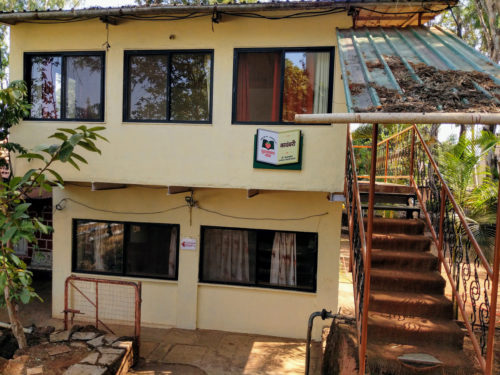
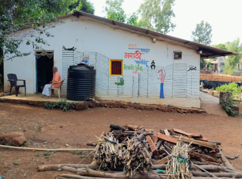
Accommodation / Stay options at Velas: There are no hotels in Velas. But almost every house becomes a homestay during the turtle season. The contact numbers of the main homestays can be found at this link. Mobile connectivity is not there at this village. This year, i heard that the landlines were also down. So, it is very difficult to reach them. But most of the mobiles are on whatsapp (there is internet, but no voice!). So message them and they will get back to you usually in a day. Almost all of the homestays are of the dormitory type i.e. mattresses are put on the floor in the main room and many people share the room/bathroom. Only two families (as of 2016) had rooms with attached bathrooms. They are Mr. Omkar Nijasure and Mr. Amol Soman (Amol’s house is veg only). They have 4 rooms each. We stayed in the 4 rooms of Mr.Amol. The average cost is around 600 a person including all meals. For the rooms, it was around 800 a person. This is a very good deal as the food is home cooked and awesome. If you are Mr.Amol’s place, ask for their Modaks and Thalipeeth 🙂 The weekend that we stayed, there were 125 cars and 2 buses in that small village with tiny lanes. A mela atmosphere, but very nice!

Velas-Turtle-Village-2

Velas Beach Turtle Village

The main beach is at the other end of the village. Due to the crowd and the narrow lanes, it is better if you walk down. From the main road, the access to the beach is through a narrow path and is around half a km. So, there is some walking needed. On this path, you can see lot of mangroves (with their roots jutting outside). When we were walking back to the road at night, we saw lot of fireflies too (the first time for me).

Velas-Turtle-Village-6

Velas Beach Turtle Village

Velas beach is actually very clean and quite big. So, velas also makes up for a nice beach destination and not just for the turtles. Because of its relative remoteness, you can be assured of minimal crowds. The kids had lot of fun in the water!

Velas-Turtle-Village-16

Velas beach

The turtle release ceremony: The ‘ceremony’ happens twice everyday, 6 am and 6 pm. Yes, people are up and ready by 6 at the beach 🙂 Mr. Mohan Upadhye is one of the main figures in turtle conservation in the village. He is an employee of the forest department and oversees the conservation efforts. He and a group of volunteers go over to the protected area and check the nests for any baby turtles which have hatched. There is lot of enthusiasm in the tourists as this happens and any turtle found is cheered.

Velas beach Turtle Village

Once all the nests are checked, the turtles are collected in a basket and taken close to the water for a release. There, a fenced off area is created within which the turtles are released. In spite of repeated requests from the volunteers, there were always the dumb/smart people who insisted on using flash and then respond with “Oh, i thought that the flash was off!”. The guy in the blue tshirt carrying the basket is Mohan.

Velas-Turtle-Village-7

Velas Turtle Village

Then, they are released onto the sand. He explained that they are released on the sand and not directly to the water as this is the natural process that happens if they were to come out of the nests themselves and go to the water. This small stretch on the sand is necessary to strengthen their flipper muscles to take on the sea. The way these baby turtles make their way to the water is amazing to watch. Accompanied by “Bhaag Milkha Bhaag” and people choosing their turtles, it becomes a virtual race where everyone wins. When the first wave hits the turtle and it disappears, the cheer from the crowd has to be experienced. Some of them get the extra help from the volunteers so that they do not get pushed back by big waves. The volunteers request people to stay away from the water for at least 10 minutes after the last turtle goes in so that we don’t inadvertently step on any of them still close to the edge of the water. In 2016, the holi weekend was the main rush weekend. We were there that weekend combining Velas with a trip to Kelshi. That Sunday evening, a record 22 turtles hatched (a 12 yr record, it seems).

Velas-Turtle-Village-9

Velas-Turtle-Village-12

Velas-Turtle-Village-14

Velas Beach Turtle Village

Velas Turtle Village

Velas Turtle Beach

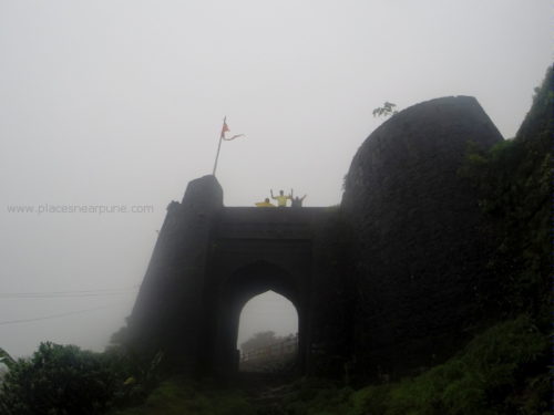
So, what do you do during the day then? You can drive up to Bankot Fort, a 15 min ride from velas. This fort has good view points towards the bay and is a great place for the evening. We started at 4 pm from velas, roamed around the fort until 5 pm, then drove over to the 6 pm ceremony. You can drive beyond the exit point to the beach and climb the road to a hill which has lot of mango farms. If you are there in summer, feast on mangoes!

Velas-Turtle-Village-18

Velas-Turtle-Village-19

Velas-Turtle-Village-20

Bankot Fort Velas Village

Trivia: How do you identify the difference between a turtle and a tortoise? yes, they are different 🙂 A turtle is primarily water-bound while a tortoise spends most of the time on land. So, a tortoise has legs, resembling an elephant’s foot while a turtle has flippers to help it swim.

If you don’t want the trouble of finding a place to stay, driving over or getting the plan done, you cal always join many of the groups which organise trips to Velas. One such group that i have heard positive reviews about is Western Routes. You can find more details on their FB Page.

Ajivali Devrai Walk – The sacred forest

$
0
0

Ajivali Devari forest walk

Ajivali is a small village in the backdrop of Pavana Dam. Around 2 kms from the village, a little higher up the mountains, is a devrai. Devrai is a sacred forest where the villagers don’t remove even fallen leaves from within the forest. So, the forest is usually very dense. One negative side effect is that the people don’t even remove the plastic plates they bring inside the forest for the festival lunch. This makes a sore sight in the otherwise beautiful forest.

Ajivali Devrai Forest Walk

Location of Ajivali and the route from Pune (Magarpatta city). Searching for Ajivali on google maps takes you to some other village also called as Ajivali. I have shown the route below. it is quite straightforward if you know the area around Hadshi temple or Pavana Dam. The last km to Ajivali is a narrow road and will be slushy in the monsoon.
That narrow road will take you to a small temple. You have to drive through the village and park at the other end.

Approach to Ajivali Village

From the village, it is an easy 2 km walk to the temple. There is a gradient, but you won’t notice it as it is very gradual. Within the first half a km, you will see a waterfall on the left. You can actually climb up the waterfall. it is small enough to be safe, but has enough spots for tons of photo opportunities 🙂 
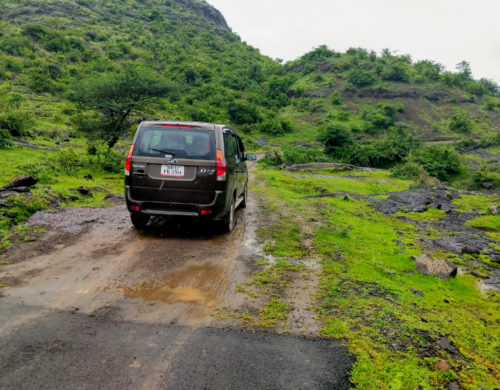
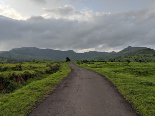
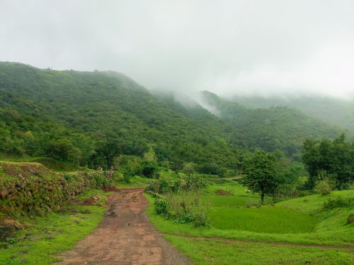
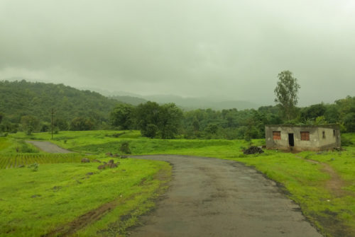
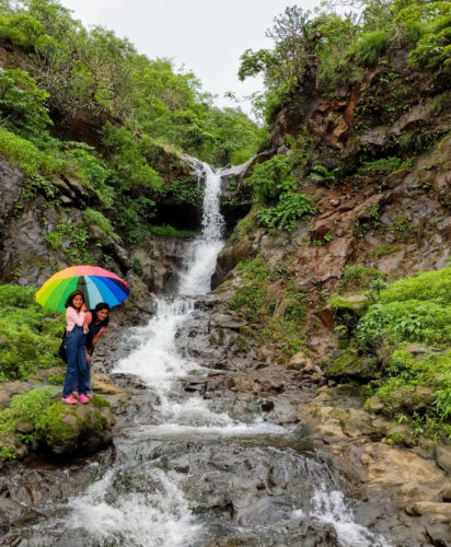
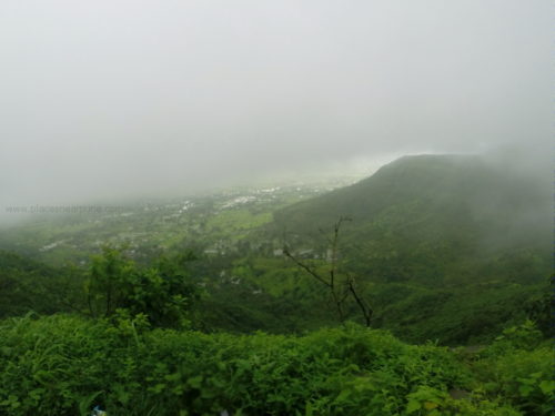
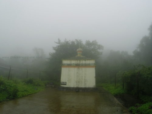
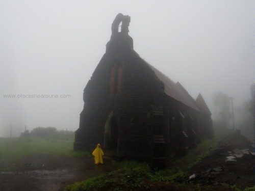
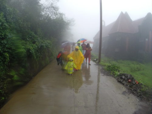
Also, there are lot of deviations from the main route which will take you to many waterfalls. There is only one stream which flows from the mountain to the village and the trail follows this stream. So, you will see many waterfalls along the route.

Ajivali Devrai Forest waterfall

The walking trail can get quite muddy in heavy rains, but it is fun. I went along with akshara and both of us had worn boots. So, water or slush, we were just walking through! Better to wear shoes or sandals with a good grip as the slush makes the path slippery. We also saw a small snake. Few other guys who knew their “snakeology” said that it was a harmless snake and even picked it up.

Ajivali Devrai Forest

The walk would take around 2 hrs with lot of stops. it was post lunch time and both of us were quite hungry. On the way back, we took a detour to hadshi temple to have sabudana, bhel and chai at their canteen. An easy one day for the family.

Hadshi Temple route

Trek to Rohida Fort – the windy fort

$
0
0

Rohida fort near Bhor is famous for its wind. I had heard about it many times and felt that it could be an exaggeration. It wasn’t 🙂

Trek to Rohida Fort near Bhor

Rohida fort was one of the forts captured by Sivaji. It is not very big in size, but interesting enough to trek to.

Trek to Rohida Fort

Route to Rohida Fort from Pune (Magarpatta City): It is a comfortable 2 hr drive from Magarpatta. For those living near the highway, the easiest way is to get on the bangalore highway and drive down in the direction of Mahabaleshwar. I took the route through Saswad and Narayanpur because it is more scenic in this season. The base village is Bajarwadi and once you enter it, you will see a huge clearing on the right meant to serve as a parking place for vehicles. The parking charges are forty rupees per vehicle. The village administration has also constructed public toilets at this parking place.


Trek to Rohida Fort

It will take around 1.5 hrs to reach the top, with lot of photo stops. The climb is gradual and easy. There are some sections in the middle where it can get slushy when it rains (and it was when we went), but there are side routes available to bypass them (just look around!). There wasn’t any stretch where we faced any major difficulty, even while carrying Advika.

Trek to Rohida Fort

The best part about this fort is the wind. During the climb, there is a flat section where the cross-wind is amazing! You really have to be watchful to make it across without slipping.

Rohida Fort

Once you reach the fort, there are three gates (darwazas). This part needs a little care as the steps are in a broken condition and they are a bit tall. Once on the top, there is a trail to take you around the periphery of the fort. It will take around an hr to have a leisurely stroll. There are 6 watchtowers around the fort – lot of photo ops! After you cross the third one, the wind picks up GREATLY. That section was fun as well as scary. You are walking literally on the edge with the wind howling like crazy. The wind was blowing into the fort and hence our fear was a bit lesser. Not sure if it ever flows in the other direction. But if it is does,
can be very dangerous.
We started from home at around 7 am and finished the trek (back at the base village) by around 12.30 pm. So, this is a relaxed day trip and fun one for all ages. This is a short video i made about the trip. Check it out here.

Panwadi Ghat – a road trip through Europe – so close to Pune

$
0
0

Panwadi Ghat Saswad Route

The beauty of Pune is that you don’t have to drive far to get out of the city and in the midst of nature. Every white road branching off from the highway has something interesting to offer. Most of us would have visited the Narayanpur Balaji temple dozens of times. That route is also quite scenic. But, a small unassuming road branching off this from road takes you on a magical , green route untouched by the crowds seen at other popular monsoon destinations close to Pune.

Panwadi Ghat Scenic Route

This route is full of roadside farms on the slopes. The terrace farming styles makes the natural streams wind their way through all the farms. There are no major villages on this route. Hencce you are practically on your own for most of the route. But the greenery keeps you company 🙂

Panwadi Ghat Scenic Route

The route map: Go to Saswad. From there a road goes towards the Balaji temple beyond Narayanpur. A little distance into this road (a little after the village zila parishad building & ground), you will see a small road branching off to the left. This road goes to panwadi. You don’t actually have to reach the village. The village is on an exit on this route. This road goes all the way to the Bangalore highway. The good thing is that at the point you reach the highway for a u-turn to return to Pune, you have a Vithal Kamat restaurant (try their Kamal Special Batata Vada!). What better than a good place for a snack break after a drive 🙂 You can then drive back to Pune on the highway or turn back into Naryanapur exit for a return through the balaji temple route (the right turn at this juntion is blocked on the highway, you have to drive for few kms to take a u-turn).


The last section of the climb down to the highway has dense jungles on the side. This view actually comes into view quite suddenly!

Panwadi Ghat

This is not the route to go on if you are looking for big waterfalls. For that, you have to go to Thokarwadi. This route is more for a relaxed, scenic green drive! I saw only one big waterfall and this too was fed by the overflow of a bund upstream and so might not always be there. But this was good enough for the kids to have lot of fun!

Panwadi Ghat Route

This is a great route for a half day trip with lunch. You can even start late in the day and be back home for dinner 🙂

Panwadi Ghat

Lohagad Fort Scorpion’s Tail – VinchuKata

$
0
0

lohagad_fort_scorpions_tail

Lohagad fort would be one of the best representations of what a Maharashtra monsoon has to offer – its history in forts and the scenic beauty during the monsoon. Climbing the fort requires a short walk of round 30 minutes and it is easy for the most part except a few patches which can become slippery in the rain. Otherwise, people of all ages can easily go to Lohagad fort.

lohagad_fort_scorpions_tail

If this is your first time to Lohagad, go to my original Lohagad fort post for all details on directions to reach there. Also, you can more photos of the fort on a very rainy day!

Lohagad Fort Trek

Upon reaching the top, most people take rest, take few photos and then come back down. But there is more to the fort than the part you see at the end of the steps. If start exploring along the border wall, you will see a grand section called the VinchaKata or the scorpion’s tail, called so due to the shape represented by the geography. This is a not-to-be-missed part of the part. It will take you a further one hour to go to the very end and return, but it is totally worth it.

lohagad fort lonavala

At many points, you walk close to the edge of the cliff. But it is safe as there are barriers installed all along the edges. Imagine a thin strip of land with almost vertical drop offs at either side. That is what Vincha Kata is. There are water tanks which add to the scenic beauty of the place.

Lohagad Fort

On an overcast day, the mist descends almost on the fort and the view from this side of the mountain is amazing. Next time you are on Lohagad, do not miss going to this side of the fort!


A super scenic road trip to Veer Dam

$
0
0

Google Maps might take you into narrow unknown roads, sometimes into dead ends. But that’s the charm of discovery. Off late, i have been spending lot of time zooming into maps and then finding roads in areas which have hills. Most of these “white roads” are not visible in the normal zoom of maps. Zoom inside and a whole network is there ready to be explored 🙂

Veer Dam Road Trip Saswad

Veer dam was on the radar for quite some time, though not necessarily for a monsoon trip. The dam’s backwaters are famous for bird watching in winter, as famous as Bhigwan. But any big dam is usually scenic and with the kind of rain we have been having this year, it should be overflowing and such a sight is worthy of a trip.

veer dam overflowing monsoon

Veer dam is around 60 kms away from Pune (Magarpatta). The main purpose of this dam is hydroelectricity and water for irrigation. You can climb of the wall of the embankments and go for a long walk. The breeze was great and the kids loved the walk. We weren’t allowed to go on top of the dam as one of the gates was open and water was being released. The view from the wall is amazing with the different colours of the water (due to the depth). Just downstream of the dam is another small dam on which you can walk on (very narrow though and kids need to be restrained). The road continues onto a small scenic bridge where you can see the water up close.

Veer Dam Pune Maharashtra

Veer Dam Pune Maharashtra

Route to Veer Dam from Pune(Magarpatta City): I am giving below three route options 1. The straight forward highway route 2. An amazing scenic route with a great food stop 3. An adventurous off road route (that i didn’t full go through), good for bikes, off roaders and adventurous regular roadtrippers!

Route 1: Veer Dam is easy to approach through the Bangalore highway. It should take you less than 2 hrs by this route. Going by this route, you can combine any other destination along the highway.

Route 2: An amazing scenic route. This option is easy if you are around Magarpatta/Hadapsar. Proceed on the Saswad/Jejuri road. Two kms before Jejuri, you will come to Madhuban restaurant on the right side (Google thinks you cannot cross the road, but you can as there is no divider). I have been a regular at this place for the past 7-8 yrs, even driving all the way for a dinner. Their kitchen is an open kitchen and amazingly clean. They serve south indian, north indian and maharashtrian – we especially love their mh food. It is a veg restaurant though. The price is very very reasonable e.g. who gives a sabji e.g. varlare vangi for 55 bucks!! Depending on the time you start, you can have breakfast/lunch here (we had lunch). Then come back a bit to the Shivri turn and then proceed towards Veer. The return can be the straight road back to saswad. The stretch from Shivri until Parinche is runway-like, smooth hillocks without any big ghat sections and a dream to drive on. You can skate on these roads! No waterfalls though, just miles of green scenery!

Veer Dam Road Trip Saswad

Route 3: An offroad trip! Disclaimer: I didn’t go through the full section, so no idea whether the road actually leads to the destination. I usually zoom in a lot of maps and start looking for twisty sections. On one such search, i came across Rameshwar Temple – a nondescript, one room temple on top of a small hillock. But the surrounding roads looked cool. Then came the plan of Veer dam. So, i found a route combining two. After lunch at Madhuban, i went towards Sakurde, crossed the narrow twisty roads of the village, to the amusement of the villagers and then reached the temple. The tarred section finished there! But then, the road begins where it ends 🙂

veer dam saswad offroad

There was practically no civilization around here and we wanted to check with someone before moving on. I had a Xylo and didn’t mind, but my friend in his swift wanted to be sure 🙂 No one came, but after some time a lone bull was the only living being that came. It didn’t seem to be in a good mood to answer queries and we had to beat a hasty retreat into our cars.

veer dam route

But then, where there is a bull, there should be a boy. And the boy eventually came. When we enquired on the route ahead, he said that there is a kuchcha road all the way ahead, but he was doubtful whether cars can go on them. He said that villagers use the road on their motorcycles. But we did want to give a try and proceeded. After a small steep climb to a pass, we came on a plateau and were rewarded with a 270 degree green paradise. In fact, the place was so quiet that when any of us spoke, it sounded like we were shouting. At this “junction”, there were two roads branching and the one showed by google was the second one below. But considering the swift, we backed out , went back to the saswad highway and took the shivri (the previous route mentioned). If any of you do go the full way on this route, do let me know.

veer dam offroad
pune offroad route

If you started early and have time left, the return trip can be made even more scenic. Try coming back through the Panwadi route to saswad. Check out the post on Panwadi. This will be an amazing dose of scenery for a day, covering Switzerland and rest of Europe in a day 🙂 Whichever route you take, do leave a comment below about your experience!

Pustakanch Gaav – Book Village – Bhilar near Panchgani

$
0
0
Book Village Pustakanch Gaav

Most trips to Panchgani start and end with a sandwich and a milkshake at Mapro. Our trip in May would have also been the same. But luck favoured us. While driving up to Panchgani, Vidhya saw a information board on the side of the road mentioning about “Pustakanch Gaav”. She immediately remembered reading about it in the newspaper a few days earlier and suggested that we should visit. We did and it was a good decision 🙂

Bhilar is a small non-descript village a few kms away from Panchgani. It is famous for its strawberry fields and folks who do manage to wander away from the main Panchgani-Mahabaleshwar road end up doing strawberry picking during the season. A couple of years ago, this village was chosen as a model village to establish a “library” in many houses. Many in the village volunteered (i think it is 27, but forgot the exact number) and all they had to do was to “donate” a room in their house to be used as a library. The govt did the rest – the books, the furniture etc.

So, what resulted was a drive-thru village with many mini-libraries. All the libraries are always open to public i.e. they are no locked. Any visitor can just walk in, read books without disturbing the house-hold. This was very cool and unique. We drove/walked around the village and visited many houses. Each library had a unique name and there were boards for directions.

I spoke to few of them and they were very happy about this initiative and it seems that the “reading habit” of the kids in the village has tremendously increased. Since it is a maharashtra govt initiative currently, all the books are Marathi ones. But i heard that may private players have shown interest and soon books in other languages will be added. Of course, people also go and donate books.

If you happen to visit Panchgani/Mahabaleshwar, allocate extra half an hour and visit this village. Very unique and you will fall in love with the concept. If you know to speak Marathi, even better. Interact with the villagers/kids and you will love the experience.

Directions to Bhilar: This map –> https://goo.gl/maps/hiEFgvqKEGPFMsxCA will give you the directions from Mapro. Of course, you should have a break at Mapro when you are there 🙂

Shirwal Buddhist caves near Bhor

$
0
0
shirwal buddhist caves near bhor

A short and sweet trip from Pune: Drive through two scenic roads, a small off-road section, a short 20 min easy climb to a set of buddhist caves and a snack stop at Vithal Kamats. Can be done in a half day trip from Pune.

Shirwal Caves Bhor

Shirwal caves are a set of around a dozen small buddhist caves located near the Bhor exit from the Mumbai-Bangalore highway. It is not a very popular tourist destination and hence you won’t get a big crowd there. One of the caves is a Chaitya, a hall housing a small stupa. Over the years, a shivling has also been added. Local villagers told us that regular pujas are done in the morning and evening.

Route to Shirwal Caves from Pune (Magarpatta): The easiest route is to go on the highway and then exit near Bhor. But, we wanted to go through a slightly longer scenic route. So, our route was something like this: From Magarpatta, we went to Saswad, came down to the highway through the Narayanpur route (As of June 2019, this road is under heavy construction, so expect bad sections), visited Shirwal, stopped at Vithal Kamats for snacks, and then returned through the Panwadi Route. There is a newly (less than 2 yrs) opened restaurant called Spice Hut near Narayanpur (at the edge of the cliff). Wonderful location for a short break. We were doing the Panwadi route in reverse for the first time and it was beautiful.

Spice Hut Restaurant in Purandar
View from the Spice Hut Restaurant
Shirwal Caves

Once you are in the highway, the turn to Bhor (under a bridge) comes after the bridge on the river (the only major one which comes before Mahabaleshwar). You don’t need to turn to Bhor. I have given the route (which is technically the first legal right turn on the highway after the bridge). The most obvious landmark you see when you are near is the HUGE tower visible from the highway (you can see in the first image on the top). Once you reach the point mentioned on the map, there is a kuchcha road (can become very slushy in heavy rains 🙂 ) which goes straight to a parking place for the caves (marked by the red arrow). If you are confused, just ask any villages/shop guy for the route.

Shirwal Caves

From the parking place, it is a short climb (choose your own route) to the caves. Nothing spectacular, but still beautiful. Small caves and as usual filled from messages from our lovely citizens! In the image below, you can see that tall tower, the cars at the parking place. That will give you an idea of the height to climb (not much)

We took the return route through Panwadi and it was a good decision. We had always done the route from Saswad to the highway (Panwadi Route). The reverse direction provided a totally different set of views to enjoy! If you are tired, just drive back on the highway. Below are some images from Panwadi route. Overall, a very nice short and sweet trip!

Panwadi Scenic Route

The side roads of Varandha Ghat

$
0
0
Varandha Ghat Off Beat Road

Varandha Ghat was considered very offbeat and remote until few years ago. If you haven’t been to Varandha Ghat, it is a must visit ghat section for the wild experience. Nowadays, shops have come up in front of every waterfall and it is no longer so isolated.

So, now it is time to explore the side roads of Varandha 🙂 These sections pass through small villages frozen in time where people would have rarely seen a car pass through. Don’t expect great roads, but the road condition is still good enough for any kind of car/bike to pass through without a problem (We had a Xylo and a Honda city). This stretch would make a great offbeat road trip.

Varandha Ghat

The route: You will go all the way to Bhor (which is the town on this side of Varandha ghat). The state highway (yellow road) goes through the regular Varandha Ghat. We will take the side one (right turn) which meets the main road after around 50 kms. You will spend around 1.5 hrs on this road without any stops. The second pt marked on the map (Unnamed road) is the location of a beautiful multi-layered waterfall (Visible from the road).

The roads are narrow, but the sights are great. And, you won’t practically find anyone! Better to go in a group (more than one vehicle) as there are no villages for kms and no mobile network too.

Varandha Ghat
Varandha Ghat

The waterfall will be the highlight of the trip. Nowadays, with crowds everywhere, it is rare to see a waterfall where you don’t see anyone else!

Varandha Ghat Waterfall

Gurusparsh Strawberry Farmstay in Panchgani – better than all those fancy villas

$
0
0
gurusparsh_strawberry_farmstay_resort

When you are welcomed with a bunch of freshly plucked strawberries, you know that you in for a sweet stay!

Panchgani & Mahabaleshwar are famous for strawberries, particularly in the winter-spring season from Jan-Mar. Every shop on the road running through these hill stations is selling strawberries and everything imaginable made out of strawberries. We are a regular every year during this season, mainly to have the sandwiches and fresh strawberry with cream and ice cream at Mapro.

This year, i wanted to stay over for a weekend in Panchgani. But, as expected, all the places are super high-priced as the demand from Mumbai-Pune tourists is pretty high. During one of these googling sessions, i chanced upon Gurusparsh Agro Resort – cottages in the middle of strawberry farms and it didn’t take long to get convinced to give it a try. This agro resort is located in Bhillar village, which is quite popular as the book village. If you haven’t been to the village, do not miss it next time you are in Mahab/Panchgani. More details about the book village here.

This farm is a certified organic one and as he demonstrated (and we followed suit), we can just pluck the strawberries and eat them directly – no need even to wash them. That was cool.

gurusparsh_strawberry_farmstay_resort

The place is run by a farmer-family – a joint family of brothers. They have individual cottages with attached baths at the edge of a cliff, with acres of farms behind them. The kitchen is run by the ladies of the house and you can get authentic Maharashtrian food at a very nominal price.

gurusparsh_strawberry_farmstay_resort

You would normally expect a very basic living space in homestays and particularly in farmstays. But, here the cottages were actually very well done. Quite spacious (even with a extra double mattress on the floor), clean big bathrooms (with geyser), good bed furnishings. The best thing – the front is an all glass panel offering you unobstructed views of the valley (from the 2 cottages at the edge of the cliff). All the cottages have a small sit-out where you can just laze all day in the winter sun.

gurusparsh_strawberry_farmstay_resort

Wait, there’s more. There is a machan erected in front of the cottages which is a cool place to sit and chat or even attend online school, which my kids did as we added a working day to a weekend (all networks work there – at least VF, Jio and Airtel did!)

gurusparsh_strawberry_farmstay_resort

So, what can you do when you are here? Of course, all the places and view points in Panchgani/Mahab are just a short drive away. We went to just relax and didn’t step out in the 3 days. You can visit their farm and try your hand at strawberry plucking. Their family members also take you on guided treks to places off the tourist radar (next time plan for me!).

gurusparsh_strawberry_farmstay_resort

Now, the coolest thing about this place. A cottage costs around 3K for a night including breakfast (very very nominal for Panchgani/Mahab). Veg Lunch/dinner costs around 200 per person per plate – good home cooked food with vegetables plucked from the garden. Also, you can skip your evening tea and go for a strawberry cream with fresh strawberries or a strawberry shake – very tasty!

So, avoid all those crowded high-priced over-hyped villas and resorts and experience comfort with this farmer family 🙂

For booking, you can reach Mr.Viswanath of Gurusparsh resort at 98238 56054.

Viewing all 81 articles
Browse latest View live


Latest Images